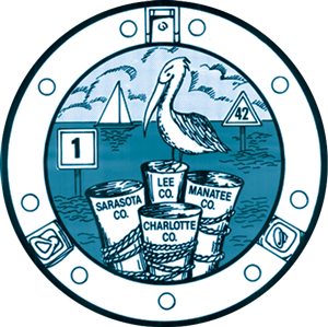
The West Coast Inland Navigation District (WCIND) is a multi-county special taxing body, covering Manatee, Sarasota, Charlotte, and Lee counties, encompassing an estimated 1.8 million people. The District plays a pivotal role in the waterway projects that promote safe navigation from the “open water” of the Gulf of Mexico or the Gulf Intracoastal Waterway (GIWW) to the systems of secondary waterways. WCIND supports county and local governments in maintaining and enhancing public navigation channels and inlets, boating access facilities, waterfront parks, and piers and special structures.
WCIND supports county and local governments in maintaining and enhancing:
- • Public navigation channels and inlets
- • Boating access facilities
- • Waterfront parks
- • Piers and special structures
WCIND also distributes boating guides, waterway maps, and other resource and information publications with an emphasis on use and stewardship of our precious marine resources.
Due to reduced federal funding, local sponsors of the U.S. inland navigation systems must now carry more of the cost of maintaining those systems. Yet, with the annual budget of approximately $4 million, WCIND currently assesses only about 20% of its statutorily allowable millage rate. The member counties of the District collaborate closely to benefit from the resources afforded by a regional approach.
Major milestones mark the evolution of our public waterways.
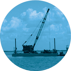
Following a feasibility study by the U.S. Army Corps of Engineers (USACE) in 1939, it was recommended to expand the intracoastal system to include a route from the Caloosahatchee River north to Anclote Key. With the outbreak of WWII, progress was halted until 1945, when Congress authorized construction of a channel 152 miles long, 100 feet wide, and 9 feet deep. The waterway was intended to link natural deep-water sections of bays through a series of man-made channels, providing safe passage for commercial goods, and access to commercial fishing grounds. Dredging began in June 1960—northward from the Caloosahatchee River toward Boca Grande—and was completed in 1967.
Upon the waterway’s completion in 1967, WCIND began maintenance activities. District responsibilities were broadened in 1979 to include improving and maintaining public channels connected to the GIWW—and any waters that made a significant contribution to waterway traffic or commerce. WCIND was also empowered to assist member counties in navigation projects, waterway research, erosion and accretion studies, and environmental restoration projects.
Although originally developed to facilitate commercial shipping to and along the Southwest Florida coast, today, the GIWW’s function is a blend of recreational and commercial use. Cruising, sailing, fishing, and eco-exploring activities predominate the present day use of the GIWW.
In 1989, WCIND was authorized to participate in even more waterway-related activities, including the promotion of inlet management, and the posting and maintenance of channel markers and manatee protection speed zone signs. WCIND also initiated programs to encourage boating safety and environmental stewardship through distribution of boater and waterway guides and resource maps.
In 1998, the state legislature required WCIND to coordinate with Florida Department of Natural Resources to post and maintain regulatory markers for manatee protection in District waterways. That same year, the legislature also consolidated all previous amendments to WCIND authority under House Bill No. 4531.

1939
1947
1960
Dredging begins – northward from the Caloosahatchee River towards Boca Grande
1967
Completion ceremony held in Venice to celebrate the completion of the waterways linkage
1977
Hillsborough and Pinellas Counties voluntarily withdraw from WCIND
1998
The state legislature requires WCIND to coordinate with Florida Department of Natural Resources
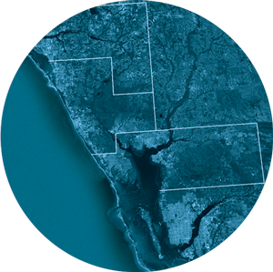
WCIND is comprised of Manatee, Sarasota, Charlotte and Lee counties.
For additional information, click on a name below to visit that county’s official website.

Federal waterways in Florida
- Atlantic Intracoastal Waterway
- Gulf Intracoastal Waterway
- West Coast Intracoastal Waterway
- Port Canaveral Lock and Canal
- Okeechobee Waterway
- Carrabelle to Anclote
- Apalachicola
- St. Johns River
- Suwannee River
- Kissimmee River
- Cross Florida Barge Canal (incomplete/cancelled)
Sustaining marine resources for future generations is a critical component of the District’s multi-year comprehensive plan.
The District promotes stewardship as a more effective means of reducing the impact of boating than adding more rules and regulations. The programs help educate the public on the ecological aspects of waterways, encourage safe boating, and encourage environmental understanding of issues. The programs generate interest in natural resources and encourage compliance with existing regulations. The resulting mindset allows more eco-friendly habits to evolve for the users of the resources. This voluntary compliance is the most cost effective means to achieve resource preservation.
WCIND has sponsored products that; promote boating safety and navigation, identify sensitive marine habitat, and broaden the understanding of waterway history and the safeguards needed to maintain a healthy environment in the growing coastal communities.
The District has also sponsored self-regulatory management initiatives that include the establishment of a Regional Harbor Board and a Marine Advisory Committee, addressing waterway issues as they occur though mediation.
Important results of this effort include:
- a system that evaluates popular recreational anchorages according to management needs – active or passive
- a model harbor ordinance for the establishment of eco-friendly anchorages
- maps and guides that promote wise use of anchorage and bay resources
The State of Florida recognized WCIND for its role in this successful self-regulatory initiative by presenting the District and program partners with the Year 2000 Environmental Sustainability Award.